 |
 |
| Kensington High Street Location Map |
|---|
Railings pose a significant danger to cyclists. In cases where a cyclist is cut up by a left turning vehicle, the pavement provides a vital emergency escape route. If there are railings present then cyclists have nowhere to go and there are a number of reports of cyclists being crushed against railings by lorries.
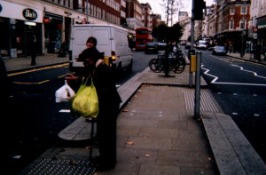
Kensington High Street
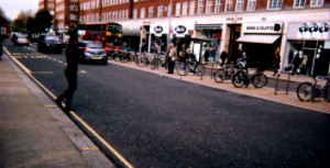
Kensington High Street is a busy dual carriageway and shopping street in central London. All guard railings have been removed from pedestrian crossings. This has created a sense of openness and empowerment for pedestrians and has been particularly appreciated by wheel chair users who can now see and be seen. This has resulted in a significant reduction in crashes.
The central median has been used to provide a well used cycle parking facility.
 |
| Warrington Library Location Map |
|---|
 |
| Sheffield Stands Birchwood Shopping Centre Location Map |
Cycle parking facilities should be conveniently located, secure and easy to use adequately lit, well signed and, if possible, sheltered. Convenience is particularly important for short-term parking.
For security a cycle parking facility should make it possible for the frame and both wheels to be locked to the fixture. Stands that support a cycle by the wheel are unsatisfactory; they are insecure and can result in damage to the bicycle.
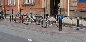
Warrington Library
These stands are convenently located close to the library entrance. The space needed to construct this excellent facility was created by reallocating a couple of car parking spaces.
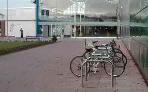
Birchwood Shopping Centre
These Sheffield stands are prominently located, near to the entrance of Birchwood Shopping Centre. The simple design supports the bycicle frame and enables the wheels to be secured to the stand. The stands are well spaced, enabling two cycles to be locked to each stand, and are well clear of the wall.
TAL 05/02 - Key elements of cycle parking provision
 |
| Wide Nearside Lane Princess Road, Manchester Location Map |
|---|
 |
| A49 London Road Location Map |
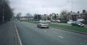
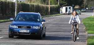
Wide nearside (left-hand) lanes offer considerable benefits in terms of cyclists' comfort and safety. They are particularly helpful where there are significant numbers of HGVs or buses. They help avoid problems that can arise with cycle lanes, particularly obstruction by parked vehicles and poor road positioning by cyclists on the approach to junctions.
To assist cyclists, nearside lanes should be 4.25m wide. This is a crucial dimension; if wider, traffic will tend to double up and create two substandard lanes.
Princess Road, Manchester
Princess Road (A 5103) is the main road heading into Manchester from the south-west. A wide nearside lane has been created by repainting the lane markings to the right.
London Road
Busy single carriageway roads also benefit from wider lanes. The A49 London Road is the main route into Warrington from the south. The wide lanes give drivers plenty of space to overtake cyclists, thus reducing conflict.
 |
| Lythgoes Lane/Pinners Brow Junction Advanced Stop Line Location Map |
|---|
 |
| Liverpool Road/Penketh Road Junction Advanced Stop Line Location Map |
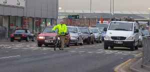
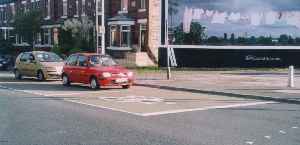
Cyclists can find it difficult to turn right at traffic lights where many motor vehicles are turning left or going straight ahead. Experienced cyclists tend to position themselves at the front of the traffic queue to avoid getting cut up. Advanced Stop Lines for cyclists accomodate this practice by providing a 5m resevoir ahead of the stop line for motor vehicles. Sometimes a cycle lane is provided to channel cyclists into the resevoir, however it is critical that this should be to the right of any traffic lane that permits left turning vehicles. Cyclists "undertaking" on the approach to junctions is a major cause of crashes, so it is important not to encourage this.
Lythgoes Lane (A49) / Pinners Brow Junction
Advanced stop lines are most useful for cyclists turning right. The cycle lane is located between the two general traffic lanes, enabling cyclists to position themselves ahead of either queue. A cycle lane in this position has the added safety advantage that, if the lights change and the traffic starts to move before a cyclist reaches the junction, then cyclist is between diverging lanes of vehicles. This avoids any possible conflicts with turning vehicles.Liverpool Road / Penketh Road (A562) Junction
This treatment is particularly valuable here. Most motor traffic turns left at the junction and there is a tendency for vehicles to turn at speed due to the shallow angle of the junction. It was common for cyclists to be cut up by drivers attempting to overtake while turning left.
The advanced stop line gives cyclists a head start and assists them to adopt a prominent road position. The wide traffic lane gives plenty of space for cyclists to overtake the queue and reach the resevoir.
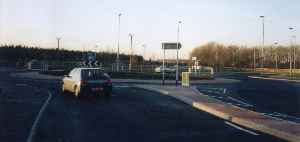 |
| Gemini Link Road - continental geometry Location Map |
|---|
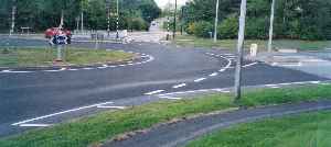 |
| Witherwin Avenue - hatching Location Map |
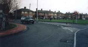 |
| Northway - traffic calming Location Map |
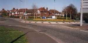 |
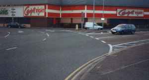
| Owens Corner - single lane entry arm Location Map |
 |
| St Mary's Green - lane markings Location Map |
 |
| Brian Bevan Island - traffic signals Location Map |
Roundabouts, particularly large roundabouts and gyratories, are the most feared feature of the road network for cyclists. With good reason: cyclists are about 15 times more likely than car users to suffer an accident at a roundabout. Small roundabouts with flared entries and large roundabouts that allow high speeds are particularly hazardous.
Ideally the number of roundabouts in Warrington would be greatly reduced. However, there are a number of things that can be done to make roundabouts safer for cyclists. Good design features include reducing the width of the circulatory carriageway, increasing deflection on entry and improving signing and conspicuity.
Gemini Link Road
Continental roundabouts are designed to a much more cycle friendly geometry than conventional UK design. The key features of continental roundabout design are:
- arms that are perpendicular, rather than tangential to the roundabout
- single lane entries and exits (widths 4-5m)
- minimal flare on entry
- inscribed circle diameter 25-35m
- circulatory carriageway 5-7m
TAL 09/97 - Cyclists at Roundabouts, Continental Design Geometry
Witherwin Avenue
This roundabout at the junction of Witherwin Avenue and Bridge Lane in Appleton was originally designed to conventional UK design. Recently, new lane markings and hatching have been installed to effectively convert the roundabout to continental geometry. This low cost treatment as greatly improved the junction both for cyclists and pedestrians and could be applied to many of the roundabouts in the new-town districts of Warrington.
Northway
This roundabout was modified as part of a traffic calming scheme to include many of the features of continental geometry. The width of the circulatory carriageway has been reduced and the entry and exit arms have been reduced to single lanes by extending the pavements.
Owens Corner
This junction is on the A49 London Road near Stretton. The roundabout has a modest diameter and features single lane entry and exit arms. This arrangement results in reasonably low traffic speeds, so the roundabout is not particularly hostile for cyclists.
Saint Mary's Green
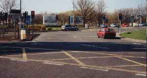
This is a very busy roundabout in Warrington Town Centre. While it would be an exaggeration to describe it as "cycle-friendly", the recent lane markings have improved things considerably. Hatching is used on the approach arms to reduce the number of lanes and increase the deflection at the roundabout. The lanes marked on the circulatory carriageway induce a more orderly traffic flow and help cyclists to adopt a good conspicuous road position.
Brian Bevan Island
Busy roundabouts are often signalised to increase the traffic capacity. A side effect of this is to greatly improve the safety of cyclists as more than half of crashes involving cyclists at roundabouts are caused by motorists entering a roundabout and failing to give way to cyclists who are circulating the roundabout.
 |
| A574 Birchwood Way Location Map |
|---|
 |
| Gainsborough Road Location Map |
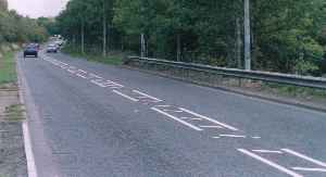
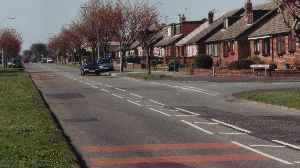
Wide hatched centre lines can be used to achieve a moderate reduction in traffic speed by reducing the apparent lane width. Drivers can use the hatched area to give cyclists extra clearance when overtaking. The greater separation from oncoming vehicles also helps cyclists pass parked cars.
Birchwood Way
The A574 is a fast and busy road serving the new town areas to the east of Warrington. The wide hatched centre line gives channels oncoming traffic further away. This gives drivers more space to overtake cyclists.Gainsborough Road
Centre hatching has been used here as a mild form of traffic calming. This is in marked contrast to measures that physically constrain the carriageway, such as central islands. In these situations it is common for motorists to race cyclists to a pinch-point, or even attempt to squeeze past through a narrow gap.
 |
| A56 Chester Road, Daresbury Location Map |
|---|
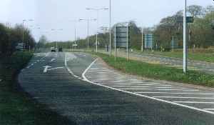
Around three-quarters of cyclist casualties occur at junctions, so good junction design is critical in order to achieve a cycle friendly road network. It is most important that drivers know where to expect cyclists to be at a junction. Layouts that place cyclists outside the driver's normal field of view are likely to be hazardous. Designs that place cyclists in front of and reasonably close to the driver tend to be safer.
Chester Road, Daresbury
Turning right from dual carriageways can be particularly difficult for cyclists as this can involve negotiating across two or more lanes of fast moving traffic. The right hand lane of Chester Road (A56) has been converted to a dedicated right hand filter at this junction with Keckwick Lane at Daresbury.
 |
| Wilderspool Causeway bus lane Location Map |
|---|
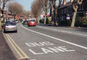
Wilderspool Causeway
Bus lanes offer considerable benefits to cyclists, both in terms of safety and convenience. Even where a bus lane operates only during peak hours, as with this example on the A49 Wilderspool Causeway, traffic tends to remain outside the lane.
The kerb-side lanes (both the bus lane itself, and the south bound lane) have been made wider than the general traffic lane in the centre. This gives cyclists plenty of space to avoid opening doors while passing parked cars. The extra space also assists other vehicles to overtake cyclists.
 |
| Croppers Road pinch point Location Map |
|---|
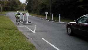
Road narrowings are often used to calm traffic, but they can be hazardous for cyclists due to motorists attempting unsafe overtaking manoeuvres on the approach - or even squeezing past in the gap. A lane width of at least 4.5m is needed for safety. Centre islands, flanked by narrow traffic lanes, are particularly problematical. Pavement Build-outs are usually less of a problem as a cyclist can choose when to enter the traffic lane in order to pass through the gap, and this can be timed to minimise conflict.
Croppers Road
This straight-through cycle bypass arrangement has direct entry and exits, thus avoiding conflicts with other vehicles. The surface is flush with road.
 |
| Evelyn Street Location Map |
|---|
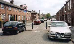
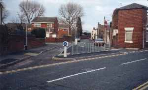
Minor streets are sometimes closed to prevent through traffic and rat running.
Evelyn Street
This cycle gap is located at the centre of the plug. This ensures that the gap is not obstructed by parked cars. The "closed" road provides a lightly-trafficked back-street route linking Sankey Valley Park to the Trans-Pennine-Trail.
 |
| Junction of Arthur Street & Froghall Lane Location Map |
|---|
 |
| Knight St, Liverpool - contra-flow cycle lane Location Map |
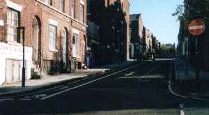
Cyclists can be seriously disadvantaged by one-way streets. They introduce additional distance, delay and often hazards at intersections where filtering and non-standard road positioning is required. Vehicle speeds also tend to increase. Arrangements that permit cyclists to use streets in both directions can redress this situation and give cyclists a positive advantage over other traffic.
Arthur Street
In this example the junction of Arthur Street with Froghall Lane has been plugged to create a "false" one-way street. A gap in the plug provides contra-flow access for cyclists.
Knight Street, Liverpool
A contra-flow cycle lane has been installed on Knight Street in Liverpool. This enables cyclists to ride along the road in either direction.
TAL 06/98 - Contraflow Cycling
 |
| Toucan Crossing at Bank Quay Station Location Map |
|---|
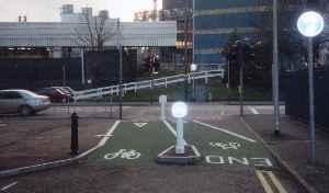
Bank Quay Station
Toucan crossings provide controlled unsegregated crossings for cyclists and pedestrians. They are particularly useful where cycle routes cross busy or fast roads.
This toucan crossing facilitates cycle access to Bank Quay Station from the town centre across Parker Street (A5061). The crossing has been aligned to give direct access from the blocked end of Museum Street, via a short clearly marked segregated cycle path. It has been constructed to a high standard, with smooth surfaces and no upstands at surface transitions.
 |
| A56 Chester Road Location Map |
|---|
 |
| Kingway, Widnes Location Map |
 |
| Cycle lane in Whitchurch, Shropshire Location Map |
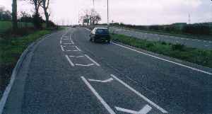
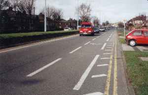
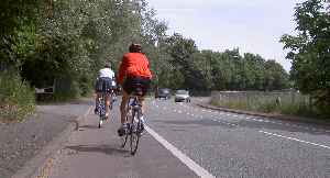
Cycle lanes can be a useful cycle priority measure. However, good design is essential to ensure their safety. Cyclists need at least 2m of road space while riding on the road. For safety, when a cycle lane is present, all this space must be available within the lane.
Chester Road
This is a good example of reallocation of road space. The cycle lane is particularly valuable on this stretch of road because of the blind left hand bends.
Kingsway, Widnes
This cycle lane in Widnes is the standard 2m wide. The hatching discourages cyclists from riding too close to the kerb (a common problem with inexperienced riders).
Whitchurch, Shropshire
The solid white line means that motor vehicles are phibited from entering this 2m wide mandatory cycle lane on London Road (B5395) in Whitchurch.